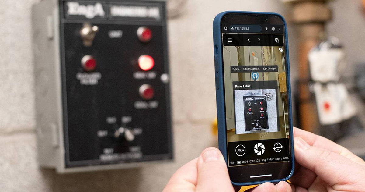
The new feature allows you to quickly add notes and images to your 3D walkthrough while onsite
Waterloo, ON, Canada, iGUIDE, an industry leader in Digital Twins and floor plans for Residential and Commercial Real Estate, Insurance and Restoration, and Facility Management, announces a new and faster way to document points of interest in virtual walkthroughs. This new feature known as Real-Time Tagging allows you to add annotations to the 3D Virtual Walkthrough immediately, while you are scanning a space. Real-Time Tagging is available now and is free with every iGUIDE package.
According to Michael Vervena, the VP of Sales & Marketing at iGUIDE, the company is continuously enhancing its technology to ensure comprehensive property documentation.
“The recent introduction of Real-Time Tagging has significantly improved the efficiency by allowing the ability to add property information and details onsite. This feature not only saves time but also expedites building condition assessments and property insurance claims.”
While documenting an insurance claim, users no longer need to wait until they leave the physical property to add descriptive details as tags. With Real-Time Tagging, they can now include notes and photos while onsite, providing immediate context and understanding of the damage.
“Customers can now use the same mobile device with which they control their PLANIX camera to capture additional pictures detailing any points of interest at the same time as they are shooting a new iGUIDE,” said Alex Likholyot, CEO and Co-Founder at iGUIDE. “This new workflow brings unique and extraordinary efficiencies to the process of documenting spaces for insurance claims, damage restoration, or facility management applications,”
Real-Time Tagging also empowers Facility Managers to optimize their workflows by eliminating tedious documenting after they leave the site and provides them with an immediate, instantaneous solution for linking physical assets to their facility management software and asset databases.
Here is how the process works:
- Scan a space with the iGUIDE camera system
- Click the Add a Tag button
- Enter text or add an image
- Place the tag marker on the image
For more information visit goiguide.com/tags#real-time.
About iGUIDE
Founded in 2013, in Kitchener, Ontario, Canada, Planitar Inc. is the maker of iGUIDE, a proprietary camera and software platform for capturing and delivering immersive 3D virtual tours and extensive property data. iGUIDE is the most efficient system to map interior spaces and features accurate floor plans, measurements, and reliable property square footage. By integrating floor plans and visual data, iGUIDE provides an intuitive and practical way to digitally navigate and explore built environments.
