Download the Ultimate Guide to Capturing and Measuring XL Interior Spaces white paper here.
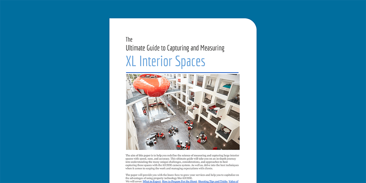
The aim of this paper is to help you redefine the science of measuring and capturing large interior spaces with speed, ease, and accuracy. This ultimate guide will take you on an in-depth journey into understanding the many unique challenges, considerations, and approaches to best capturing these spaces with the iGUIDE camera system. As well as, delve into the best techniques when it comes to scoping the work and managing expectations with clients.
The paper will provide you with the know-how to grow your services and help you to capitalize on the advantages of using property technology like iGUIDE. We will cover: What to Expect, How to Prepare For the Shoot, Shooting Tips and Tricks, and the Value of Using iGUIDE.
What to Expect
DON'T BE SCARED. Size really doesn't matter, all that much.
Shooting large spaces, over 100,000 square feet can be surprisingly easy. It is exactly like small spaces, just BIGGER. Simply put, you will need to shoot a panorama, line up your data and repeat multiple times. Perhaps even during the course of a few days, until complete. That, more or less, covers the basic workflow.
But of course, there is a bit more to it than simply following a workflow that is similar to smaller residential properties. Although, in essence, all you really need to do is create more panoramas and put in some extra effort before shoot day. Having a good understanding of your clients’ requirements for the finished product, in the commercial property realm is critical.
Larger properties may have more demanding clients with less time to waste. Thus, it is absolutely critical to have a clear understanding of the scope of work and expected deliverables.
How to Define the Scope
The size and complexity of the property can significantly raise the cost and time required to complete the project. It is best to ask questions to ensure both you and the client are in sync.
- Is your client just looking for a floor plan or do they want to showcase the property?
- What features are important to them?
- What will the finished product be used for?
If the details and features are not as important, you will only need to capture enough panoramas to get the laser measurements and depict things such as windows, doors, and features. Minimal effort is required to include what is necessary for the professional drafters to create the floor plans. This will significantly reduce your time spent on site and should be taken into consideration when providing a quote. So get clear about the client’s needs ahead of time and save yourself the headache of overselling or not truly understanding their expectations for the final deliverables.
The key steps to understanding the work that needs to be done, in order to achieve your client’s objectives, include:
- Identify and document the client’s goals and objectives
- Be clear about the major milestones and required tasks
- Make a note of and discuss timelines specific to the project
You may find this Project Requirements Checklist handy when discussing the scope of work with the client. There are many different processes to follow at the initial stages of a new project and it is imperative to cover all of the ground you need first hand.
Needs Discovery
A Broker trying to sell the property will have very different needs than a Property Manager or Commercial Developer.
For a Brokerage trying to sell or rent the property, you will want to budget extra time to capture features that communicate the value of the property. These may include interior, exterior, and aerial viewpoints to properly showcase the relevant details. Giving prospective buyers the full scope of the property and surrounding area can help viewers understand the full investment and value of the location.
Whereas, many industrial buildings can be quite simple, rectangular structures, with little detail and wide-open spaces. Measuring and capturing spaces like this can be fairly simple and the Property Manager may only be more interested in getting the floor plans for insurance purposes or space planning.
There are many different types of properties that fall into the supersized, over 100,000 square feet category. Each with its own unique challenges, managed by clients with very different needs. Below are some common types of properties you may encounter and things to keep in mind with each type of project.
Common Types of Large Properties
Multifamily: A building that has multiple units for family housing. Can be owned by a single person who rents out the units. Each unit can also be owned individually. A few examples of properties that are rented and owned by a single owner and are more likely to fall within the larger space category, include:
- Duplex/Triplex/Quadruplex - For these, it will be important to determine if the client is looking to rent, manage the property, or sell the lot.
- Garden Apartments - 3-4 stories with 50-400 units will have similar requirements.
- High-Rise Apartments - High-rise apartments are found in larger markets, usually have 100+ units, and are professionally managed.
Office: Usually grouped into three classes. Reonomy provides a great explanation of each on their site. A brief explanation is included below:
- Class A - buildings are considered the best of the best in terms of construction and location. Here you will probably pay more attention to detail and the customer may have more to spend to showcase the property.
- Class B - properties might have high-quality construction, but with a less desirable location. Aerial views may not be as important for showcasing these types of properties.
- Class C - are those that might be fairly dilapidated and in an unfavorable location. Most likely to shoot for repurposing projects or insurance purposes.
Industrial: Are typically used for manufacturing, processing, and warehousing purposes.
- Manufacturing - These types of properties usually have machinery for the end-user, and require substantial renovation to re-purpose for another tenant.
- Process and Assembly - These are much simpler in structure and usually can be easily reconfigured to have the best processing time. Typical uses include storage, product assembly, and office space.
- Warehouses - Can be classified as Flex that can be easily converted and, very large Bulk property types, normally in the range of 50,000-1,000,000 square feet. Bulk properties are used for regional distribution of products and require easy access by trucks entering and exiting highway systems.
Retail: Used primarily as shopping centers, include:
- Community Retail Center - Normally in the range of 150,000-350,000 square feet
- Power Center - Generally have several smaller, inline retail stores, but is distinguished by the presence of a few major box retailers, such as Wal-Mart, Lowes, Staples, Best Buy, etc. Each big-box retailer usually occupies between 30,000-200,000 square feet.
- Regional Mall - Malls range from 400,000-2,000,000 square feet and generally have a handful of anchor tenants such as department stores or big-box retailers.
- Out Parcel - Most larger retail centers contain one or more out parcels, which are parcels of land set aside for individual tenants such as fast-food restaurants or banks.
- Strip centers: Named for their straight configuration, these centers generally focus on convenience tenants such as dry cleaners, nail salons, and sandwich shops. Strip centers are smaller than 30,000 square feet.
Health Care: According to Law Insider these properties can operate as a nursing home, an acute care hospital, a rehabilitation hospital, an assisted living facility, an adult congregate living facility, a personal care facility, a medical office building, or any combination of the foregoing; provided that any of the foregoing may also include independent living units as part of such property.
- Medical centers, hospitals, nursing homes - Have very complex layouts, small hallways, little rooms with large equipment. Attention to detail and extra time will be needed when capturing these spaces.
- Senior housing - With COVID social distance and being able to make adjustments to floor plans and designated isolation areas are becoming more relevant in nursing homes. Floor plans can, thereby, play a major role in helping to manage space planning in these properties.
Hospitality (Hotels/Leisure): These are most likely commercial premises, including:
- Full-service hotels - usually located in central business districts or tourist areas and include big-name flags like Four Seasons, Marriott, or Ritz Carlton. Location is important, so aerial and drone footage may be advisable.
- Extended stay hotels - have larger rooms, small kitchens, and are designed for people staying a week or more.
- Amusement parks, Bowling alleys, Stadiums, Zoos, etc. - Marketing these leisure experiences offer many opportunities for additional services such as virtual staging, videography showcasing events at the location, and the addition of information tags in a unique way to showcase the products and services.
Infrastructure Sector: Typically structures that are made for the benefit of the general public, including:
- Utilities - These include electric, gas production, transmission or distribution of water, telecommunications, waste disposal, etc. They can be owned by a person, group, corporation, or government body depending on your location. More likely than not, there will be a professional Property Manager on site. There may be some safety policies and procedures, as well as, a need for wearing special equipment when on site.
- Transport- Typically include a number of other buildings on-site and have containers that house large transportation equipment. Security and privacy should be considered and discussed with the client when capturing these types of properties.
- Data Infrastructure - A data center is a physical facility that is used for housing servers and critical applications and data. You will find many large data center complexes in Silicon Valley. A great deal of thought goes into the location and security at these locations. Privacy is of utmost importance. Typically do not offer public access. Google offers a great FAQ to learn more about data centers, in general, and their specific properties here.
This section should have given you a good overview of the types of properties you may encounter on your XL interior space capturing journey. What the customer base may look like and key services they may be interested in will be covered next.
Customer Types and Service Requirements
Understanding the space is important, but understanding more about the different customer types servicing these XL spaces, and what their reasons are for the project, is crucial too. It will help you to formulate and submit a competitive bid, be better prepared to complete the work, and ensure that the final deliverables accomplish the client’s objectives.
The below table breaks down the most common types of customers you may encounter, types of service offerings for their clients, and some things to keep in mind when working with these types of customers.
Customer Type |
Key Service Offerings |
Clarifying Questions & Considerations |
|
Commercial Brokerage/Real Estate Services |
|
|
|
Commercial Property Management |
|
|
|
Commercial Development |
|
|
|
Architects/Engineers/Construction |
|
|
|
Property Condition Assessments |
|
|
Now that you have a better understanding of the types of properties and customers you will be faced with when working on capturing these supersized properties, it’s time to focus on the brass tacks and discuss the most important part of capturing these spaces: planning the shoot.
How to Prepare For The Shoot
As mentioned before, the most important part of shooting a large interior space is preparation. Time may be a constraint, so it is important to plan ahead. Send your client a Staging checklist before the shoot. It can help ensure you make good use of the time you have available and can focus on capturing the space as opposed to dealing with trying to access locked rooms or helping with staging, unless of course that is part of the service you are offering for your hard hours of work.
Experience is the best teacher but here are some extra Dos and Don’ts for preparing to capture a larger property:
Do
- DO budget extra time.
- DO bring a flashlight.
- DO check with the client to confirm if you need any special equipment that will not be provided, like steel toe shoes.
- DO book multiple shoot days ahead of time and clearly communicate which areas you will be focusing on for each day. You may not need the extra time as iGUIDE is known for its speed, but it will make you appear more professional, and you can always cancel if you finish ahead of schedule. Which I am sure your clients will be happy about if billing by the hour.
- DO shoot more than you need. Especially for clients interested in showcasing the property.
- DO map out the shoot. You need a logical route to follow on the day of the shoot. Best to get access to a floor plan they may already have or do an initial walkthrough of the property and hand sketch some notes with markers of where you intend to shoot the panaos.
- DO set client expectations for the day of the shoot(s) ahead of time. The Staging Checklist will help give them an idea of what to expect.
- DO get nondisclosure agreements signed if using models or capturing unblurred images of personnel on site.
- DO be a stickler for any security, safety, special equipment or other building policies and procedures that need to be followed while on site. Make sure you review prior to the day of the shoot.
- DO test your tripod on wheels. It makes it easier to move around the space and maintain the same alignment for each shot. But probably best to test before the day-of.
- DO charge your batteries and be sure to bring extras just in case. For both the iGUIDE system controller, camera and your smart device.
- DO review any security or privacy policy and procedures. There may be a lot more risk to privacy than you may think depending on the nature of the business.
- DO consider backup equipment you may need to take with you (Extra batteries, Battery chargers, Extra tripod, Number of photographers and equipment, Possible back up camera).
- DO have a clear understanding of the space including traffic considerations and parking availability.
- DO consider the time of day when booking the shoot(s), natural light challenges and needs. Back up light may be needed.
- DO determine the number of individuals needed to complete the work within the time required and requirements of those individuals (need to be there during such and such times).
- DO make a note of Windows (numbers, locations and sizes), skylights and mirrors (large groups of mirrors) when planning your pano route.
Don’t
- DON’T go in without a plan.
- DON’T forget to make sure your batteries are charged.
- DON’T forget to turn off the scanner if they do not care about floor plans.
- DON'T forget to pack all of the equipment you need the night before.
- DON’T forget to bring your fit tracker or step counter app to wow everyone with your stats for the shoot day.
- DON’T waste your clients time by not being prepared
- DON’T waste your time capturing high quality photos if all they care about is the floor plans and measurements.
- DON’T forget to consult the Scoping Checklist and rely on the project objectives to anyone assisting you with the shoot.
Now that you have the “What” figured, it’s time to move on to the “How” of it all. Without the knowledge of tips and tricks to ace these shoots, the job is still far from being done. That brings us to the next section.
Shooting Tips & Tricks
If you have yet to do so, please take some time to watch our Master Class on Shooting Large Spaces. It is chalk full of useful tips and tricks from our resident Photography Guru Chris White .
In summary, follow these simple steps when dealing with a large space:
- Budget extra time.
- Plan a route.
- Follow a predictable pattern.
- Select Map Actions/Grow Map in Survey to double the size of the map.
- Face the camera in the same starting direction for every pano.
- Follow the interior perimeter if necessary.
Plan a Logical Route
Be sure to do a walkthrough and/or ask for an existing floor plan or blueprints and mark off where you would like each pano, prior to the visit. Don’t forget to bring it with you the day of and mark off each completed location. Since the camera system is nonlinear you can go wherever you want and shoot how you would like. But, for bigger spaces planning a route becomes more important. It helps to shoot in a logical sequence.
The route you choose will depend heavily on the shape, complexity and size of the space. Following a predictable pattern will help the user keep track of where he/she is when navigating through the space. It will also allow you to more easily check your work while post-processing.
Range of the laser is about 10 meters so do not exceed that between panos or you will be cutting it close. For larger rectangular empty spaces, you can start with moving around the primitor of the interior wall and then a straight path through the middle.
It’s helpful to divide up large properties into separate floors even though they are on the same level. This will give the user the ability to focus on one area at a time. This will require you to combine these areas later in Stitch by dragging panoramas from one floor to another.
Keep in mind special considerations such as accessing restricted areas that may require someone letting you into the space or having to pre-book a room to ensure it is not in use so you may have to capture different parts at different times. You may want to allot extra time for more detailed areas and spread out the shoot over multiple days if accessing certain parts is only possible during a given time in the day.
Data Alignment Considerations
To make data alignment easier, face the camera in the same direction for the start of every panorama. This will cause the shot direction indicators in Survey to be facing the same direction every time. The initial shot direction determines what is shown first when a panorama is loaded. With bigger properties it can be helpful to align your very first pano and square it to the bottom of the screen. If you do that, you subsequently need to align every pano after, which isn't advised for smaller residential properties but can be quite helpful in larger properties. Do not use AutoMap. The system is not that smart, it will get confused in a large space. Aligning as you go and following a logical sequence of the property is your best bet.
When you build and grow the data you will eventually hit the limit of what your canvas can show. Use the Map Actions/Grow Map option. This will double the size of the map and allow the user to work on larger spaces. A space over 100,000 square feet can easily fit on a phone screen with no problems. You can also center the data. It will take all of the data you captured and move it to the middle of your screen. It is best practice to recenter and then eventually grow the map when it is necessary. It provides better resolution in our experience using this approach.
If Using More Than One Camera
If you use more than one camera to shoot a project, here are the steps that must be followed to combine the data correctly.
The lens on each camera is calibrated individually and that calibration (system.cfg file) is copied into every project’s folder and is then used for stitching panos during export and producing pano tiles and photosphere images.
- Data from each camera needs to be loaded and processed in Stitch separately first. Do all color and pano alignment adjustments at this step and export the projects to generate stitched output images. You do not need to align laser data at this step.
- Delete all export folders for simplicity, as export images are also stored in original pano folders.
- Copy floor folders shot with other cameras into the project folder of one camera. If you used different cameras to shoot rooms on the same floor, then only copy pano folders into correct floor folders.
- Load the project in Stitch and arrange floors and rooms as needed.
- Do laser data alignment on each floor, but do not adjust any pano colors. It is better to not even open the Adjust panel.
- Export and upload to the portal for drafting.
If these steps are not followed, the pano alignment on all cameras, except one, most likely will be out of whack. If your project already got drafted, then you can do only step 1 and use Replace Pano on the portal to update pano tiles.
Extra! Extra! Tips- Read all about it!
- System battery will last you between 8-10 hours. Bring a spare battery for the camera. It may last between 6-8 hours and dont forget a backup smart device and your charger. you should probably have 2
- Outdoor panos cannot be used for measurements but may be very useful to the client and valuable for including the exterior condition of the building and neighbourhood information
- When shooting spaces that you don't want drafted, just shown, simply capture without the laser measurement data and communicate to the Drafters that you only want it shown. Best way to communicate this is to put them on separate floors and call them what they are: Amenities, Exterior, Barn. This way they are easily accessible via the Floor Selector.
- Google Street View is for public spaces only. Confirm if there are areas of the building they want to show. To turn it on when creating the iGUIDE you just have to enable it via the checkbox or you can also do it from the packages and add ons in the Portal
- Keep pano distance between 15-20 feet and try to capture details in common from one pano to the next
- Periodic review of data for continual - review quality and data memory devices(prior), possible backup sources (extra thumb drives)
- Multiple panoramas of the same space with different set up may be required. The intended purpose is to show different purposes or uses of a space. i.e. a banquet hall set up as a dinner, for a wedding, for presentation with stage, or tradeshow, etc. (This section may move down to use Case strategies)
- If you use more than one camera to shoot a project, here are the steps that must be followed to combine the data correctly. The lens on each camera is calibrated individually and that calibration (system.cfg file) is copied into every project’s folder and is then used for stitching panos during export and producing pano tiles and photosphere images.
If you have any useful tips and tricks be sure to start a thread in our iGUIDE Discussion Forum.
The Value of Using iGUIDE
The value iGUIDE brings to capturing large spaces doesn't only reside in its efficacy, ease of use and speed. The LiDAR laser scanner allows for accurate and defensible measurements. This allows for quick capture and delivery of interior geospatial data used by our Drafting team to create floor plans and provide reliable square footage information used by cross discipline groups for your client to be able to get a good grasp of spacial awareness, and building information.
Floor plans
You may come to find that floor plans are of utmost important to your clients. There are a number of reasons why spatial awareness and interior maps would be desirable information to have in hand. Especially if those hands belong to a first responder where access to detailed floor plans can become critical or even life saving to have.
Imagine if you will, the example of a Firefighter who needs to access a multi-unit building or manufacturing plant and the building design, layout and contents are all unknown, yet having the ability to move quickly and navigate the space to find people is of utmost importance. To do their job effectively and mitigating their own risk factors would require great spatial awareness which relies on having accurate, reliable and easily accessible floor plans.
Accurate 2D and 3D layouts and models allow you to make decisions and easily operate in an unfamiliar environment. The visuals can be personalized to locate assets, hazards, and specific interiors. The optimal path inside can be determined without prior visits onsite.
Accurate indoor spatial data also enables Property Managers to run “what if” scenarios so they can plan for new equipment, make safety plans, and necessary upgrades and changes to the layout and configuration, etc.
Accurate Measurements and Square Footage Calculations
Considering regional measurement requirements and the process by which measurements are obtained are important. They are relied upon by buyers, contractors, interior designs, etc., to make informed decisions about the property. But more importantly the liability will lay upon the realtor/builder/seller for these mistakes.
There are many methods used to calculate square footage. Some States and Provinces have their own set of standards and regulations. In the US the most commonly used standard for measuring office buildings is published by the Building Owners and Managers Association International or BOMA for short. This standard was first established in 1915 and has changed various times to reflect industry changes. You can review the BOMA Standards here.
What sets iGUIDE apart from other traditional used methods is that they are accurate and defensible in court. The IMS-5 uses time-of-flight laser scanning technology with thousands of laser points per second versus a single laser point, used by handheld laser distance meters. Measuring the distance to walls with 1cm uncertainty out to 10 meters (30 ft) distance. The measurement uncertainty on floor plans is 0.5% or better and the resulting uncertainty of computed square footage is 1% or better.
iGUIDE Method of Measurement is summarized here.
Both Alberta RMS (residential measurement standard) and BOMA (commercial space measurement standard) call for maximum allowed measurement uncertainty of 2% when reporting square footage measurements. iGUIDE technology meets and exceeds these requirements.
Easy Access and Delivery
With an easy to use shareable link, it takes the user directly to the iGUIDE. This can be easily embeddable into internal sites. Case specific views and be created to deliver or use copies of the same iGUIDE with multiple different views of a space. Start at different spots showcasing specific rooms, floors or spaces, for a variety of purposes:
- Property documentation
- Space planning tool
- Internal secure use
- Sharing a different view with different people specific to their needs. I.e. Sharing an available space for lease or rent in a large building, you can create a specific iGUIDE view to share with a specific or group of clients so that they can walk in to that space through the public access areas and into that specific rooms without the ability to enter secure or other private spaces
- Public facing view that is being shared with an external clients
- Shared spaces for Google Street view
Analytics on the backend you can gleam interest and views to specific clients or spaces from analytics dedicated to each iGUIDE view.
Conclusion
I hope this narrative provided some clarity on measuring large commercial spaces and the best course of action when creating your plan.
The iGUIDE system allows for documenting the precise order and condition of large interior structure and its contents in a speedy, accurate and efficient way. Documenting this can be quite time consuming and expensive using traditional methods.
If you have any questions or concerns, please do not hesitate to contact our Support Team for guidance.
White paper:
The Ultimate Guide to Capturing and Measuring XL Interior Spaces